Santo Antão - Green Paradise for Hikers!
It is one of the volcanic islands of the Cape Verde Islands and is home to the highest mountains of the Cape Verde Islands. Santo Antão is also known for its picturesque villages and stunning scenery. Santo Antão is one of the greenest islands of the Cape Verdean archipelago and is considered by many to be the most scenic.
Santo Antão
Santo Antão is the second largest island of the Cape Verdean archipelago, with an area of 779 square kilometers. The landscape contrasts, with a barren and desolate south and west but a subtropical north and east with rich vegetation. In the mountains, corn, ananas, coffee, and manioc are grown on terraced fields of black lava and white pozzolana.
The island is rich in different types of plants, such as pine and fir forests, palms, lemon trees, papaya and orange trees, and more. The approximately 50,000 inhabitants live mainly in the four cities of Porto Novo, Ponta do Sol, Paúl, and Ribeira Grande. The people of Santo Antão combine Cape Verdean joie de vivre with a rough side. The music style “Colá” is trendy here.
Some travelers do island hopping and spend only one or two days on each island. On Santo Antão, however, you can stay a week and still have plenty to do, especially if you like hiking and outdoor adventures. Most of the towns are relatively close to each other, so you can easily jump from one place to another.
Santo Antão is a paradise for hikers. The island is full of fantastic half-day and full-day hikes. Usually, a short taxi ride is enough to reach an exciting hiking route. If you have little time on the island, you should plan at least two days for hiking (one for Cova to Cidade das Pombas, the other for Ponta do Sol to Chã de Igreja). In this way, you can do the two most spectacular walks.
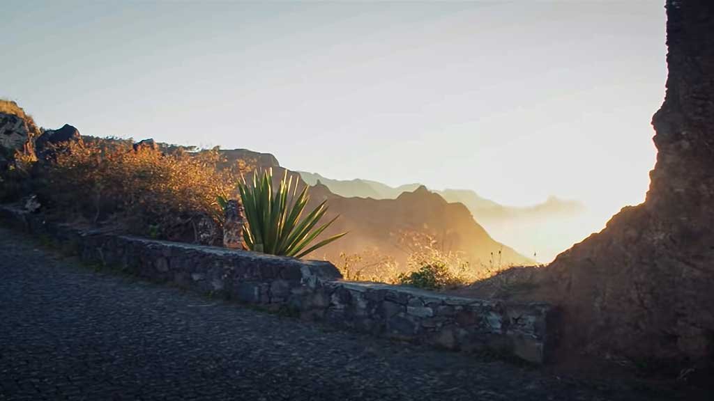
It is recommended to take the old road from Porto Novo to Ribeira Grande to discover the fascinating contrasts of the island of Santo Antão. The road takes you past steep cliffs, through pine forests, and over narrow mountain ridges to the north coast. On the way, you will pass a volcano from which you will have a breathtaking view of the surroundings. You can see the whole island and even the neighboring island of São Vicente from the top of the volcano.


Ribeira Grande – Capital of Santo Antão
Ribeira Grande is the capital of Santo Antão and is located in the valley of the same name. It stretches across the island’s northern part, with rugged mountains and a road that runs along the edge of the southern part, offering spectacular views. The steep slopes are terraced to grow corn and other vegetables and fruits. The volcanic soil and the constant moisture from the clouds are a perfect recipe for a good harvest. Above Ribeira Grande is an ancient cobblestone road with some of the most exhilarating bends in the world!
Although the island was discovered in 1462, the first evidence of settlement dates from 1548. The main settlement was Ribeira Grande, which became the seat of the municipality of Santo Antão in 1732. The old buildings are in Portuguese colonial style. There is a church called Nossa Senhora do Rosário and a food and clothing market. The town has a lively atmosphere with small shops and restaurants but few hotels. There is an internet café near the church. Porto Novo is the next largest town on Santo Antão, located in the dirty southeast of the island. There is a main street with mansions, a small church, markets, shops, and the port to discover.
The Paúl Valley of Santo Antão
It is undoubtedly one of the most stunning places on the Cape Verde Islands. It is the greenest valley on the Kapverdian Islands and is mainly used for agriculture. Mangos, passion fruits, bananas, sugar cane, and many other plants grow here abundantly.
The trail to climb the ridges of the Paúl Valley winds along the terraced slopes of the valley, climbing up and down the numerous ridges. The hilly nature offers many different viewpoints of this beautiful landscape. The unique thing about this hike is that the views constantly change, and there are new surprises around every bend and curve.
At the hike’s highest point, you will be rewarded with a panoramic view of the entire valley. The Paúl Valley is both wild and cultivated. The great variety of products cultivated prevents it from suffering the fate of most agricultural landscapes, which tend to specialize in only one or two plant species.

©Igor Tichonow – stock.adobe.com
Vila das Pombas & Ponta do Sol
Vila das Pombas is a coastal village about 10 km east of Ribeira Grande on Santo Antão. It lies on a sheltered bay in the northeast, surrounded by pastel-colored houses and fields of sugar cane and coconut palms. A little further away, in Passagem, a lovely swimming pool is set on several terraced plateaus. Hikers can stay at the rural Aldeia Manga, which consists of several mud huts and a large stone house. In Cha de João Vaz, near Alfred, a nice restaurant with homemade liqueurs and grogue variations exists.
The coastal road from Paúl leads north to the former Jewish settlement of Sinagoga. To the south, the road leads through the Ribeira da Janela, past a grogue distillery and the lighthouse of Janela, to the petroglyphs at Pedra da Nossa Senhora. In the western part of the Ribeira Grande valley, a visit to the picturesque village of Chã de Igreja, situated in a ravine, is worthwhile and can be reached from Ponta do Sol. On the way, you can visit the exciting villages of Fontainhas, Corvo, Forminguinhas, and Cruzinha da Graça.
Ponta do Sol is a beautiful place on Santo Antão. There are hotels, pensions, restaurants and bars. Driving from Ribeira Grande to Ponta do Sol is an experience in itself, as the road runs right along the sea. The west of the island is best explored from Porto Novo. The road leads to Ribeira das Patas and on to the highest point of the island, the Tope de Coroa. Tarrafal de Monte Trigo is a green oasis. There is a mile-long black lava beach and natural stone bungalows run by a German-American couple (https://www.martranquilidade.com/).
Hike from Cova Crater to Cidade das Pombas
If you have time for a hike, you should do it. I guarantee you that you will be overwhelmed by the view. The walk takes about 6 hours.
The trail starts at the Cova crater. The easiest way to get there is to take a taxi. Be sure to bring plenty of water and food. There are not many places to eat along the way.
The crater is simply stunning. It takes about 45 minutes to reach the edge of the crater, where you will be rewarded with one of the most beautiful views of Santo Antão. From here, you descend to the Paúl Valley at a dizzying height. The hike is not technically challenging, but you will undoubtedly feel the effort in your legs at the end of the day. The town of Paúl, halfway down the trail, is ideal for a lunch break.
 ©Frankix – stock.adobe.com
Hike from Ponta do Sol to Cruzinha
This hike offers very different landscapes than the Cova Paúl hike – and some of the most impressive on the island. It follows a cobbled sheep track that zigzags along the coast, stopping at several remote villages not connected to paved roads.
If you want a shorter version of this hike, you can start in Ponta do Sol and hike to the incredibly scenic Fontainhas, a small hamlet that clings to the steep cliffs like a mountain goat. Be sure to stop by the Bar Tchu for a drink. The hike to Fontainhas and back takes about 2 hours.
Fontainhas
In any case, it is worth continuing to the Chã de Igreja, a hike that takes about 6 to 7 hours. After Fontainhas some of the most dramatic cliffs appear. I was in the heaven of hikers for many hours, wandering along the windy paths and watching the wild sea crashing against the rocks below.
In the tiny village of Formiguinhas, from which one has a beautiful view of the sea, one can have lunch, but also a little earlier, in Corvo, there is the possibility of having something to eat. A plate of catchupa with smoked sausage will give you the necessary energy for the rest of the hike.
This hike is often windy, as it leads directly along the coast. The last hour before Cruzinha is very exposed to the sun and feels like an ordeal. From Cruzinha or Chã de Igreja, you can easily drive back to Ribeira Grande. Chances are good that some riders are already waiting there.
Video: Cabo Verde – Pearl of Africa
Transportation on Santo Antão
Public Minibuses & Taxi
The cheapest way to get around are the minibuses, the aluguers. With them, you can drive for only 100 Escudos (about 1€) from one city to the next. Keep in mind that the aluguers may take a while to fill up. There are two important roads on Santo Antão. One is the “new coast road” from Porto Novo to Ribeira Grande. Much of it is paved, and the trip is fast and cheap. Take this road if you want to get somewhere quickly.
There is also the cobbled “old road” that goes right through the mountains. You will usually need to take a taxi here. It is very scenic, and you will probably take this road at least once or twice to get to different hiking trails or viewpoints. However, the fares are much higher than on the coast: One way up the road costs about 2000 Escudos (€20), although you can share the bill if you are traveling with several people.
Renting a car on Santo Antão
You can also rent a car, which I did for two days of my stay. For hiking, a vehicle is not so helpful (none of the hikes are circular), but it just makes fun to drive around the island with a car. It is also easier to reach the remote town of Tarrafal with a car. Porto Novo has several car rentals near the ferry terminal.
Most of the roads on Santo Antão are cobbled but well maintained and little used. Potholes were no problem at all, but keep an eye out for the occasional free-roaming goat or the like.
Getting to Santo Antão
The island used to have an airport, which has since been abandoned. There are plans for a new airport, but that will take some time. The only way to reach Santo Antão is by ferry from the city of Mindelo on the neighboring island of Sao Vicente. The ferry costs about 800 escudos for a single trip, takes about an hour, and runs several times daily.
For more information on the other islands of Cape Verde, please see our island guide. Everything about entering the Cape Verde Islands can be found in our blog article!
